Congaree National Park Geotechnical Explorations
S&ME has been fortunate to be the geotechnical engineer of preference for Liollio Architecture for several projects at Congaree National Park over the years under their IDIQ Contract with the US National Park Service (NPS). Projects that occur on US NPS land require special coordination with the Park Rangers and, depending on the site location within the park, can have special access issues. Some recent projects are detailed below:
Boardwalk Replacement (2018, 2021)
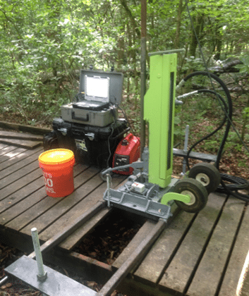
The existing boardwalk system emanating from the Harry Hampton Visitor Center consists of seven sections of elevated and low wooden boardwalk, as well as ground trail, that create access from the visitor center to Wise Lake and Weston Lake. Due to the nature of the terrain and the NPS designation of “wilderness”, access for exploration was limited to the existing boardwalk and a 2-foot buffer along the existing alignment. Our exploration consisted of CPT soundings and ERT arrays. Using this unique approach geotechnical properties were collected at select CPT sounding locations, while profiling of the full alignment was performed with the ERT (electrical resistivity tomography).
South Cedar Creek Bridge and Canoe Launch (2023)
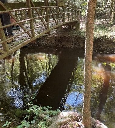
The existing Kingsnake Trail pedestrian bridge crossing of Cedar Creek was reportedly built in 1976 while the existing canoe launch is reportedly estimated to have been constructed in the 1970s or 1980s. It is reported that erosion of the creek banks has undermined the existing bridge and concrete steps of the canoe launch. Therefore, the bridge and canoe launch are to be removed and replaced with a new, single-span, roughly 60 to 70-foot long by 6-foot wide wooden bridge over Cedar Creek, rip-rap slope protection installed on the abutment end slopes and side slopes, and a new, canoe launch ramp with a possible retaining wall for stairs along the ramp. Our exploration consisted of SPT mechanical soil boring, hand augered soil boring with DCP testing and CPT sounding with downhole shear wave velocity measurements. The area was accessed by the existing gravel trail from the parking lot, however, access was not available across Cedar Creek, resulting in only manual exploration on the far side of the replacement bridge alignment.


