Subsurface Imaging with Geophysics
Our geophysical services provide nondestructive testing for geologic investigations, helping teams with geotechnical analysis to characterize and model what’s beneath the ground.
What’s included:
- Seismic velocity and electrical resistivity geophysical surveys
- Stratigraphic, structural features, site variability and disturbance subsurface imaging
- Geologic hazards, subsurface anomalies, voids, buried features and objects detection and characterization
When it’s needed:
- Sites with limited access or constraints on geotechnical drilling
- Early-stage exploration to guide subsurface investigation
- Projects requiring rapid, nondestructive testing
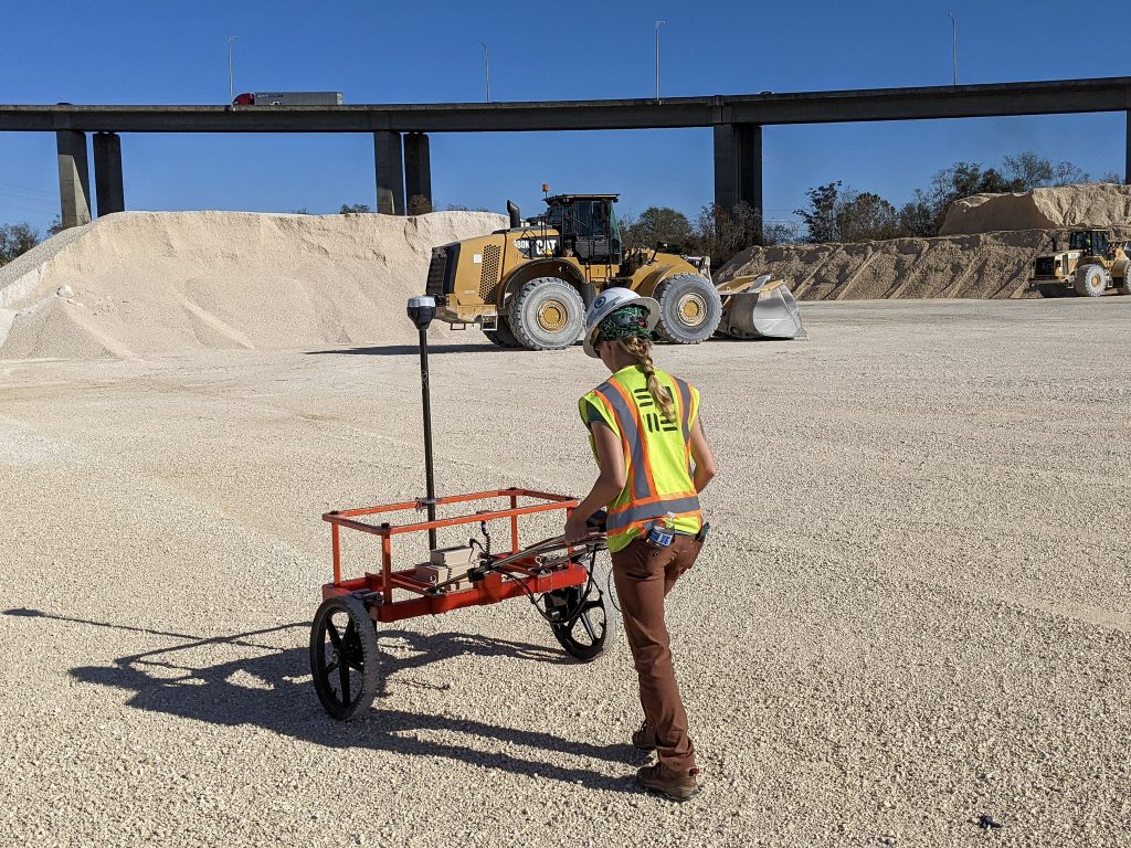
Nondestructive Testing for Site Characterization
Geophysical surveys are an environmentally low-impact field technique that provide complete spatial analysis without the need for large-scale clearing or specialized equipment.
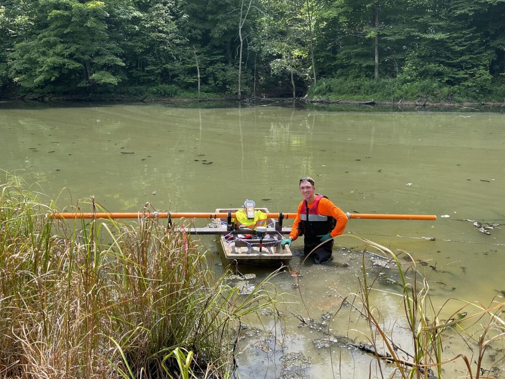
Subsurface Imaging for Difficult Access Sites
Geophysical exploration can cover surface terrain inaccessible to geotechnical drilling, conducting surveys in environmentally regulated areas, elevated terrain, or even urban environments.
Our Technical Approach to Geophysics
Effective geophysical consulting combines advanced surveying and mapping with geologic and geotechnical analysis to provide a clearer understanding of subsurface conditions and material properties. Our approach begins with defining the project objectives and selecting the most appropriate geophysical method or combination of methods. We then perform carefully planned field investigations, process the data using industry-standard and proprietary software, and subject our interpretations and reporting to technical peer review.
Discuss Your Project With Our Team
Common Uses for Geophysical Testing:
- Infrastructure & Transportation: Evaluate pavement thickness, subsurface voids, dam integrity, embankment conditions, and seepage pathways to support design, maintenance, and rehabilitation.
- Building Design & Subsurface Surveys: Investigate foundation elements, subgrade and subbase materials, underground storage tanks, utilities, and reinforcing steel to reduce subsurface uncertainty and improve construction planning.
- Geologic Hazards & Risk: Identify faults, voids, karst features, weak zones, and unstable ground conditions that may affect structures, foundations, and slopes.
- Environmental & Groundwater: Delineate contamination, landfill boundaries, buried materials, and groundwater conditions to support environmental assessment, monitoring, and remediation.
- Subsurface Characterization & Materials: Evaluate soil and rock properties, depth to bedrock, weathering profiles, and other constructability factors to guide geotechnical design.
Using modern geophysical equipment and advanced processing software, we collaborate directly with engineers, architects, and environmental professionals. Our goal is to deliver clear, actionable subsurface data that reduces uncertainty and supports informed decisions throughout planning, design, construction, maintenance, and remediation.
See How Geophysics Can Support Your Next Project
Reliable subsurface insight begins with selecting the right geophysical method for your site and project objectives. Our Geophysical Services Guide explains commonly used methods, their typical applications, and the factors considered when designing an investigation. Real-world project examples show how geophysics can address site-specific challenges and reduce subsurface uncertainty.
Get the Geophysics Guide Sent to Your Inbox
Project Feature: Geophysical Exploration for Gas Pipeline Design
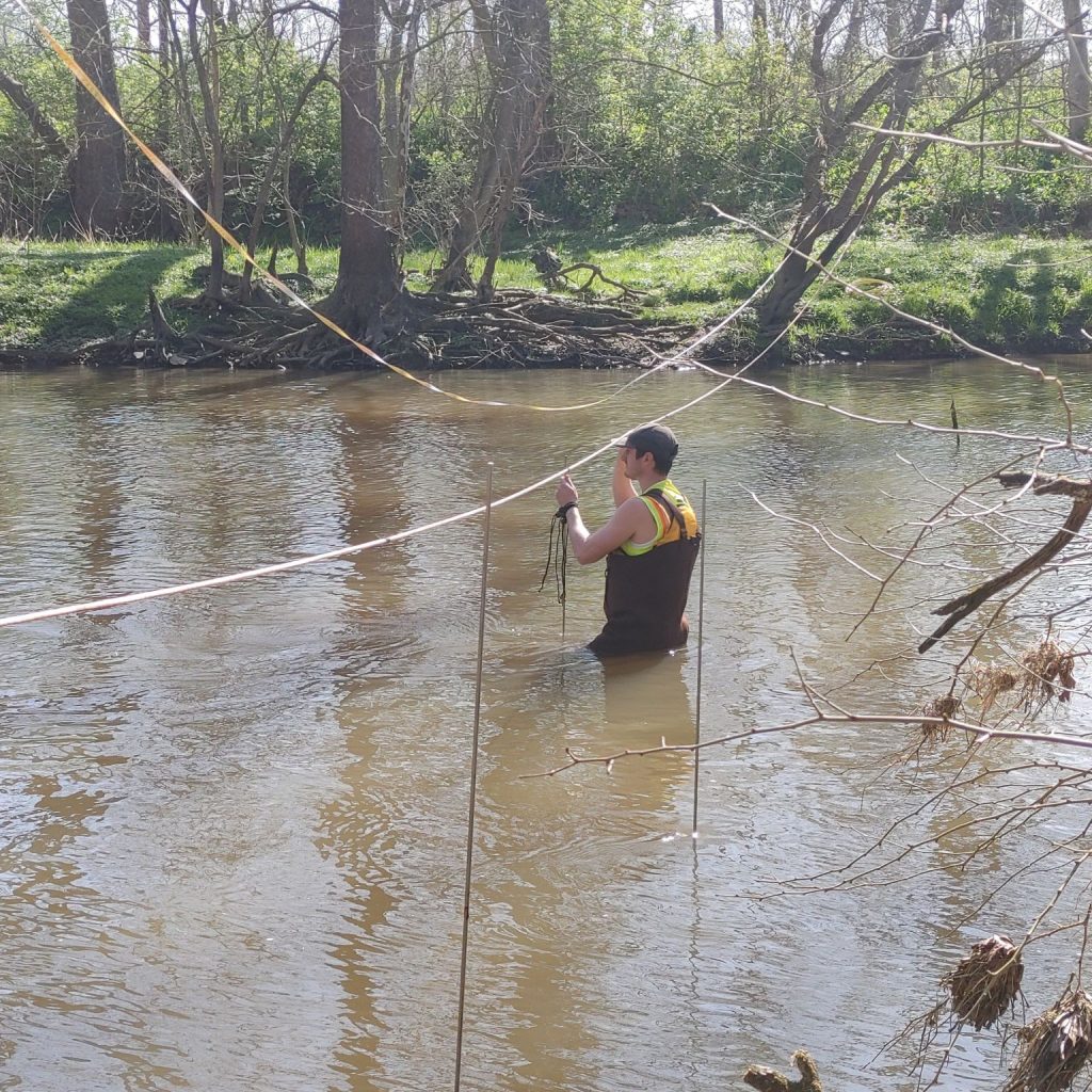
S&ME used geophysical methods to characterize subsurface conditions along a gas pipeline alignment crossing beneath a creek and river into the Piedmont Province’s complex metamorphic terrain. Previous horizontal directional drilling encountered significant bedrock fracturing and faulting, creating a need for additional subsurface information to support design and construction planning.
Project Highlights
- Reduced subsurface data gaps by characterizing fractured and faulted bedrock between discrete drilling locations.
- Adapted the geophysical investigation to site constraints using Electrical Resistivity Tomography (ERT) across wide river sections where two-dimensional Multichannel Analysis of Surface Waves (MASW) was not feasible.
- Supported design decisions by providing geophysical data to help inform pipeline alignment, drilling feasibility, and construction planning.
Geophysical Testing Methods
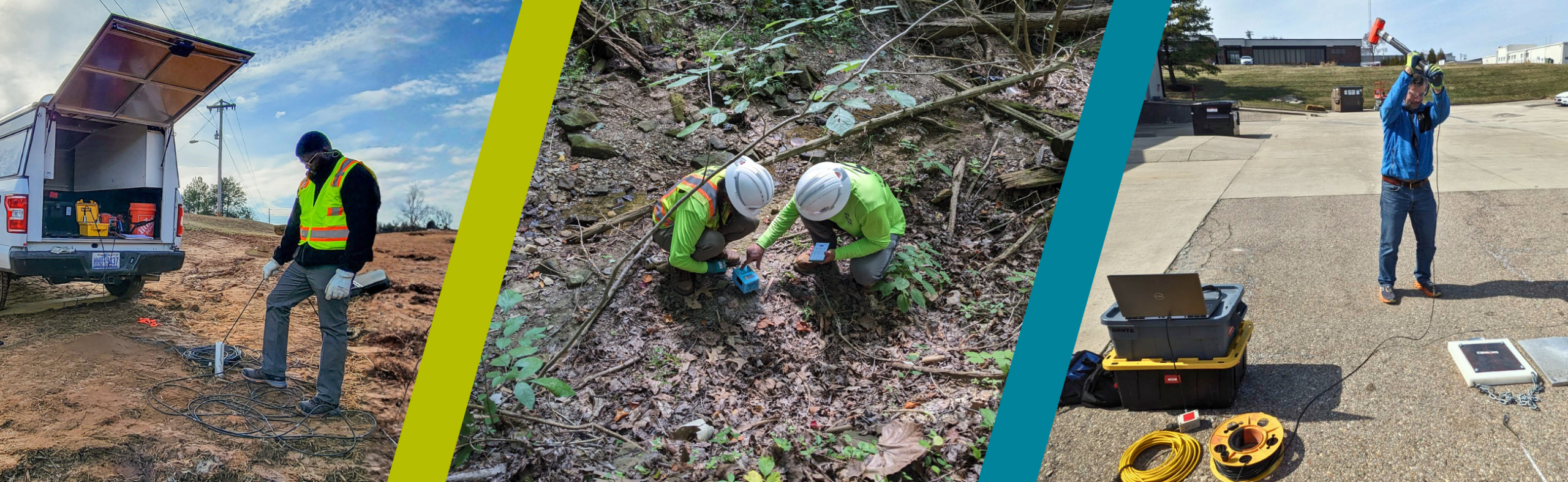
Suited to site conditions, project objectives, and access constraints, S&ME helps project teams with geophysics. We tailor our approach to each project’s needs, using either a single technique or a combination of complementary methods to maximize coverage and deliver more reliable interpretations.
Find the Right Testing Method for your Project
Project Feature: Geophysical Evaluation of Karst Conditions at Barbuda Airport
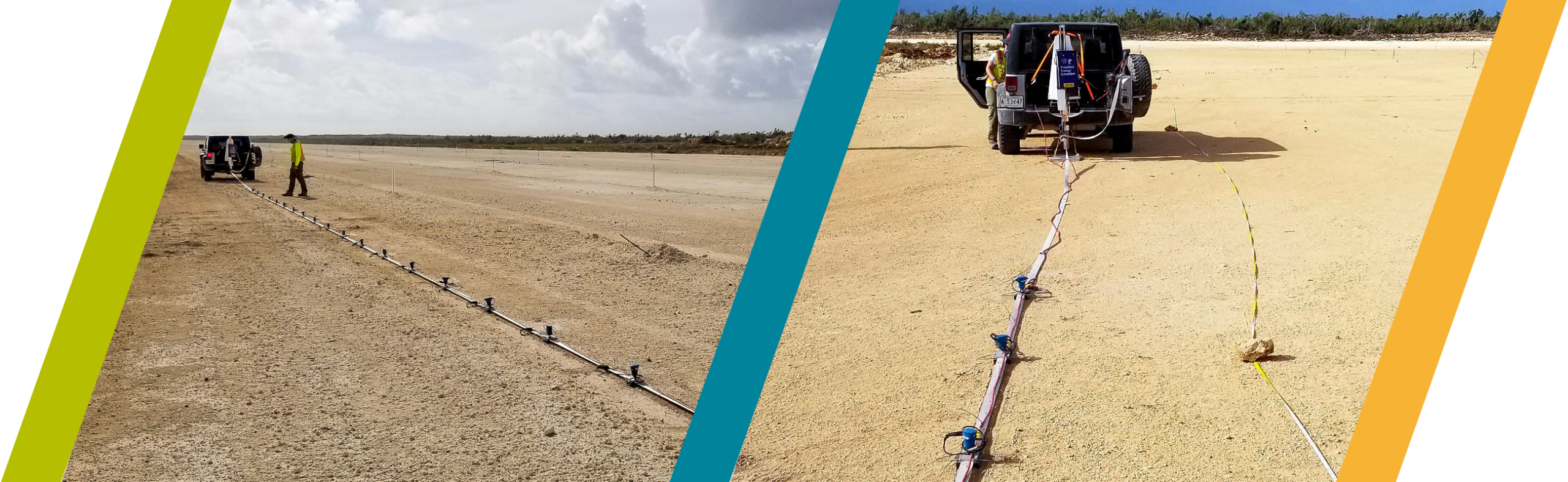
S&ME used MASW to evaluate potential karst conditions along a planned 7,100-foot airport runway and its associated taxiway, apron and building areas. The investigation characterized subsurface variability across the site prior to construction.
- Expanded investigation coverage by collecting 19 MASW profiles totaling approximately 55,000 feet using a landstreamer and accelerated weight drop.
- Identified subsurface variability through mapping changes in shear-wave velocity that indicated porous limestone and potential cavities beneath the site.
- Focused geotechnical drilling by using lower-velocity zones to guide boring locations. Subsequent drilling correlated these zones with porous limestone and cavities.
What’s Under Your Airport Runway
Need a Geophysical Survey?
Geophysical surveys transform subsurface measurements into actionable site information. S&ME combines anomaly maps, subsurface visualizations, and integrated geologic and geotechnical analysis to help project teams evaluate risk and make informed decisions throughout planning, design, and construction.
Each survey report clearly explains the findings, their significance, and recommended next steps. Recommendations may include targeted soil borings, additional nondestructive testing, or construction-phase considerations based on the conditions identified.
Geophysics Services FAQ: What Our Clients Ask Most
+ How does geophysics improve site characterization?
Geophysics improves site characterization by identifying changes in soil, rock, groundwater, and buried features between discrete investigation points. These methods can:
- Map lateral and vertical subsurface variability across large areas.
- Help select targeted locations for geotechnical borings and other follow-up testing.
- Support earlier identification of geologic hazards and unexpected site conditions.
- Extend subsurface understanding between borings, test pits, and cores.
+ How do geophysical services detect sinkholes, voids, and other geologic hazards?
Geophysical methods can identify contrasts in subsurface physical properties that may be associated with cavities, loosened soils, weathered rock, or other karst-related conditions. Common methods include:
- Ground penetrating radar (GPR)
- Electrical resistivity (ERT)
- Seismic surveys
- Microgravity
+ What are the benefits of a GPR survey in construction planning?
A GPR survey provides shallow subsurface imaging. The rapid, nondestructive method detects utilities, pavement layers, voids, reinforcing elements, and other buried features. GPR surveying can:
- Provide continuous subsurface information with minimal disturbance.
- Help identify potential risks and hazards before excavation, coring, or demolition.
- Reduces uncertainty when planning construction sequencing and targeted investigation.
Learn about the benefits of GPR and more of its applications.
+ Can geophysical testing identify issues beneath airport pavement?
Geophysical methods support airport pavement evaluation by assessing conditions beneath runways, taxiways, and aprons without extensive coring or excavation. GPR, seismic testing, and other methods can help characterize:
- Pavement and base-layer thickness
- Potential subsurface voids
- Weak or deteriorated zones
- Variations in subgrade and foundation conditions
- Areas that may warrant targeted coring, drilling, or additional testing
Learn more about Federal Aviation Administration (FAA) pavement standards and repair strategies.
+ What is geophysical imaging and mapping?
Visualize shallow and subsurface conditions with little to no ground disturbance. These methods can locate embedded and buried features, characterize material changes, identify voids and other anomalies, and provide valuable information for engineering design and maintenance decisions
- Ground Penetrating Radar (GPR): Locates embedded or buried features and characterizes shallow subsurface changes.
- High-speed Roadway GPR: Evaluates pavement-layer thicknesses and identifies changes in roadway conditions.
- Sub-Bottom Profiling (SBP): Delineates sediment layers and other subsurface conditions beneath bodies of water.
- LiDAR and Photogrammetry: Develops high-resolution surface models to support mapping, design, and geophysical interpretation.
Common applications include:
- Detect interfaces and contrasts between materials, such as concrete and metal, asphalt and aggregate, or sand and clay.
- Locate embedded or buried features, including reinforcing steel, underground storage tanks, or debris zones.
- Identify anomalies that may be associated with voids, sinkholes, or changes in stratigraphy that may impact stability.
- Develop continuous or near-continuous subsurface profiles to supplement discrete information obtained through drilling and coring.
+ What are electrical and electromagnetic geophysical methods?
Measure subsurface electrical properties to characterize changes in Earth’s materials, groundwater conditions, and buried features. With limited ground disturbance, these techniques help project teams evaluate geologic conditions, identify potential hazards, and reduce subsurface uncertainty.
- Electrical Resistivity Tomography (ERT): Maps lateral and vertical changes in subsurface electrical resistivity. Pseudo-3D and 3D ERT surveys extend coverage across larger areas and complex site conditions. These methods can identify variations in associated bedrock depth and weathering, groundwater and seepage, voids, buried materials, and other subsurface anomalies that may affect design and construction.
- Wenner Four-Pin Soil Resistivity Measurements: Measures soil resistivity to support the design and evaluation of grounding systems and corrosion-control measures.
- Spontaneous Potential (SP): Measures naturally occurring electrical potentials that may be associated with groundwater movement, seepage, and other subsurface processes.
- Time Domain Electromagnetics (TDEM): Characterizes subsurface conductivity to identify conductive zones and investigate changes at greater depths.
- Frequency Domain Electromagnetics (FDEM): Maps changes in apparent electrical conductivity and magnetic susceptibility to identify variations in soil, rock, groundwater, and buried materials.
+ How do seismic geophysical methods support geotechnical investigations?
Seismic and vibration-based methods evaluate how energy travels through soil, rock, and engineered materials. The resulting velocity and frequency data help characterize material stiffness, depth to bedrock, subsurface layering, and lateral variability. These methods support geotechnical design, geologic-hazard investigations, void detection, pavement evaluations, and assessments of foundations and other structures.
- Multi-Channel Analysis of Surface Waves (MASW): Develops shear-wave velocity profiles to evaluate soil and rock stiffness, depth to bedrock, weathering, weak zones, and other subsurface conditions. Applications include geotechnical site characterization, karst investigations, and void assessments.
- Microtremor Array Measurements (MAM): Uses ambient vibrations to develop shear-wave velocity profiles at greater depths. MAM may be used independently or combined with active-source MASW to expand the investigation depth range.
- Seismic Refraction (P-Wave and S-Wave): Maps changes in seismic velocity to estimate depth to bedrock, identify material boundaries, and characterize variations in soil and rock conditions.
- Horizontal-to-Vertical Spectral Ratio (HVSR): Evaluates ambient-vibration resonance patterns to estimate a site’s fundamental frequency and identify significant subsurface velocity contrasts.
- Downhole Seismic: Measures compressional- and shear-wave velocities within a borehole to characterize subsurface materials and develop seismic parameters for geotechnical and structural design.